
Habitats of our stag beetles
Info
On this map you can find out if stag beetles have ever been sighted in your locality or in neighboring communities. The map will be updated periodically as evaluation of additional communities is currently underway. No exact finding locations are disclosed here. Therefore, the finding site can also be located in the forest of the municipality in question, i.e. in the entire district. The map represents finding reports since the year 2000, focal points are 2011, 2012, 2013,2014, 2015, 2016, 2017, 2018, 2019, 2020 and 2021, so it gives a very current status of the stag beetle distribution. The current year is shown on a separate map.
Map of the locality (cities) and their district without exact locality.
NEW: Download the distribution map of the stag beetle in Rhineland-Palatinate here.
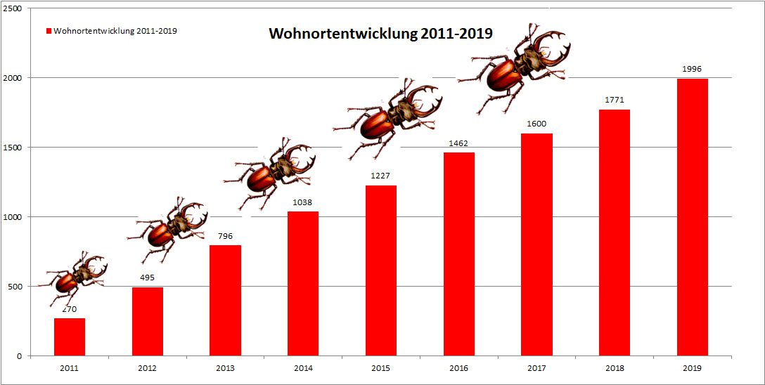
The residential development statistics reported at this point cover the years 2011 to 2021 and include all reports we have reviewed and deemed to be reliable. The localities are differentiated according to postal codes. The residential development shows that there are still a lot of new parishes being added each year, so we’re not there yet! However, our search does not yet tell us very much about the endangerment of the stag beetle in the respective region. However, the more widespread distribution than generally assumed, as well as the large number of perennial reports, are already a reason for cautious optimism!